FarmIT 3000 - Colouring or Filling Field Areas
Farm IT Help - Colouring or Filling Field Areas
Using colour to display information on the map and therefore make the map more usefull is of course a very useful tool. This is available to both Gogle maps and custom maps.
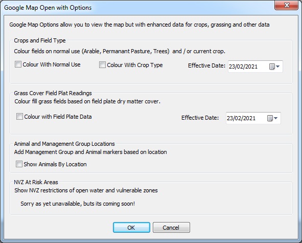
Colouring or Filling Field Areas Google Maps
You may colour your field areas with specific s colours representing the use, crop or plate
readings relevent to the field. Once you have created the map and added your field boundry object you may open the map with the 'Open - With Options' menu to dispaly the options available. Note that the Effective date is used to select the appropriate record, for example the crop which was in the field on the effective date. It is thus possible to display the information for last season or last month and opposed to current crop.
Colouring or Filling Field Areas Image Maps
One of the most usefull feature of FarmIT maps is the ability to colour or fill
field boundries with specific symbols or colours representing the use, crop or plate
readings relevent to the field. You must however plot the field boundries first
in order to do this.
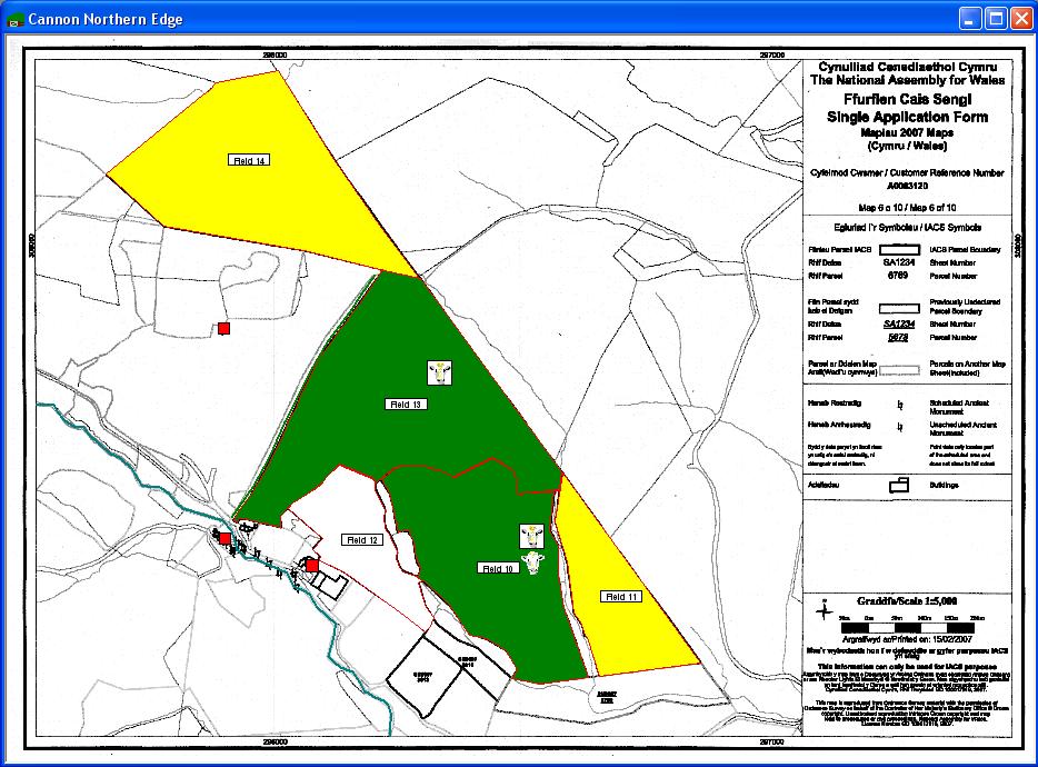
For example we may wish to show a map with all permentant pasture shown in green
and arable land shown in yellow.
You may colour the fields in one of two ways, either in edit mode or in normal mode.
Map In Edit Mode
In edit mode you may select and colour individual fields by either selecting the
field (Left click once within the boundry) then selecting the fill
from the toolbox...
 or ...
Double click the field area to edit the properties...
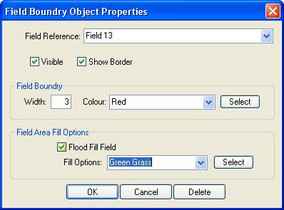
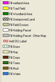
Tick the Flood Fill Field box and select the fill option or select a specific colour.
Finally click OK to apply the changes.
Map In Normal Mode
You may also flood fields when the map is in Normal Mode. In this mode you can choose
to fill fields based on specific criteria, for example current use, crop etc.
First right click on the map to display the popup menu.
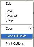
Choose the 'Flood Fill Fields' option to display the fill options.
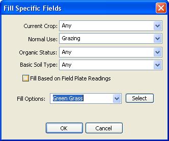
You may flood fill the fields based on any mixture of criteria, simple select the
options from the four drop down lists, then select the fill option, either a fixed
option like 'Green Grass' or click the select button to select a specific colour.
Field Plate Readings
If you wish to fill the fields based on field plate readings simply click the tick
box, the actuall colours used to fill the fields will then depend on the field plate
reading. From white through to dark green.
The numeric range for field plate readings is configurable, you may change this
on the Farm Details, configuration options tab. The fill colours then use the range
to colour the fields from light green through to dark green based on the actual
readings recorded. Please note that at present the last field plate reading for
each field is used.